
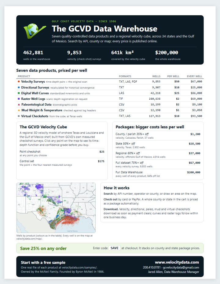
The GCVD Data Warehouse flyer
One page: the warehouse in numbers, the seven products with their prices, the velocity cube, package pricing and how ordering works. Letter size.
Download the flyer (PDF, 850.5 KB)Data / Coverage maps & flyer
Print-ready coverage maps of each product, with a key to what it is, how it's delivered and what it costs, and a one-page flyer for the whole warehouse. Free to download and share.
One page: the warehouse in numbers, the seven products with their prices, the velocity cube, package pricing and how ordering works. Letter size.
Download the flyer (PDF, 850.5 KB)Each map is an 11 × 8.5 in landscape PDF. Every well shown is in the catalog and can be bought on its own, by county or state, or as a package.
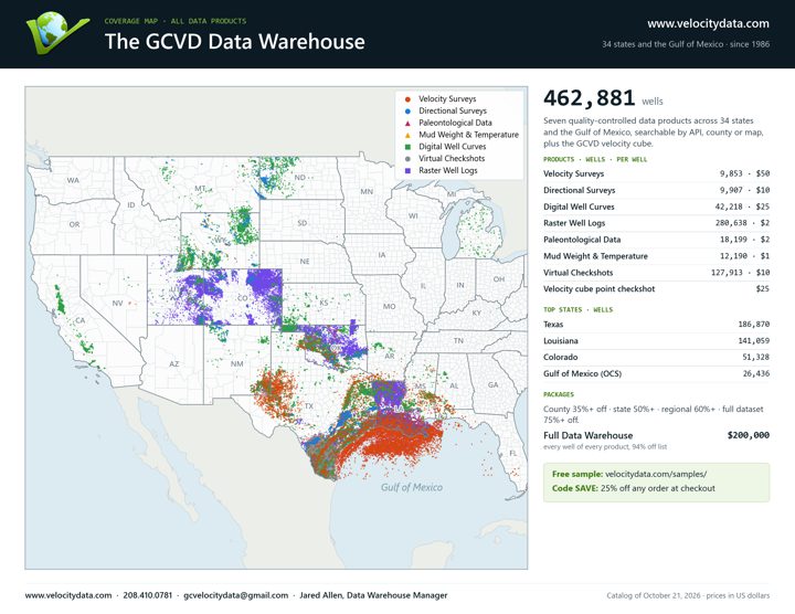
Every product in the warehouse, on one map
PDF (2.3 MB)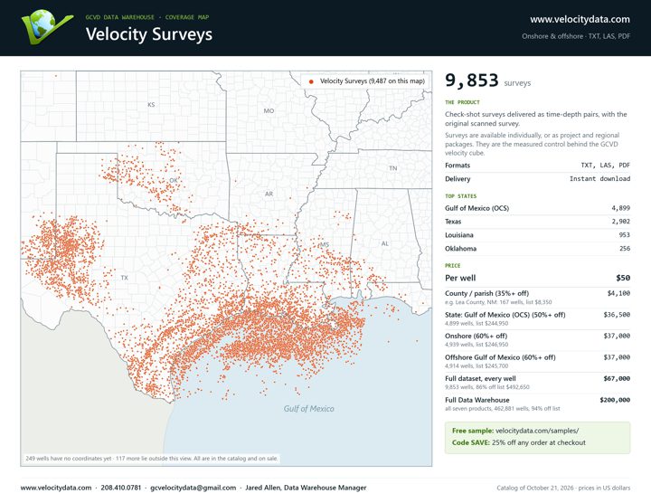
Check-shot surveys delivered as time-depth pairs, with the original scanned survey.
PDF (2.4 MB) On the map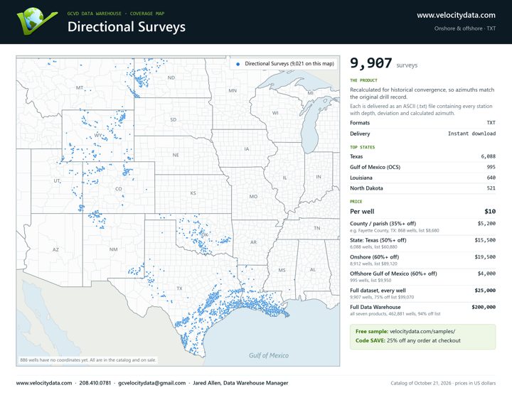
Recalculated for historical convergence, so azimuths match the original drill record.
PDF (2.0 MB) On the map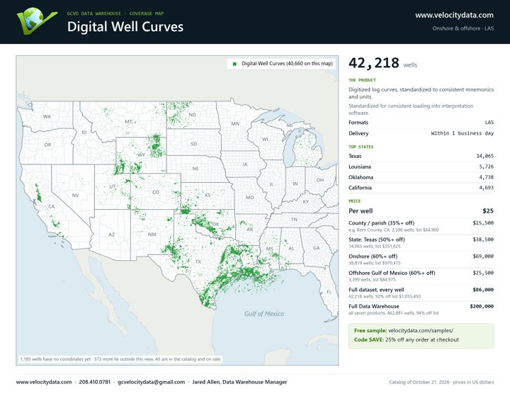
Digitized log curves, standardized to consistent mnemonics and units.
PDF (1.8 MB) On the map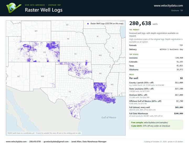
Scanned well logs, with depth registration available on request.
PDF (1.9 MB) On the map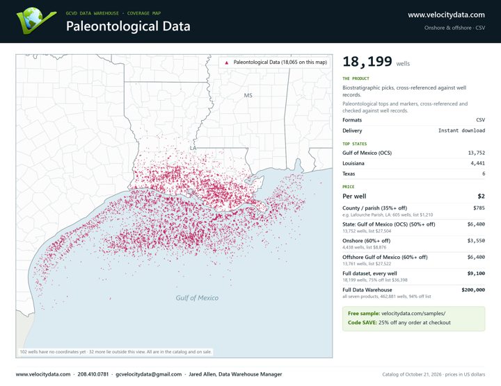
Biostratigraphic picks, cross-referenced against well records.
PDF (1.7 MB) On the map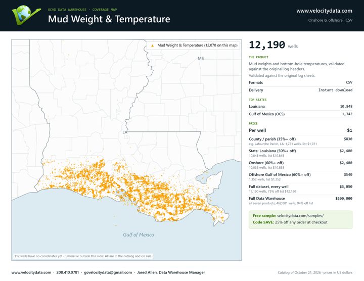
Mud weights and bottom-hole temperatures, validated against the original log headers.
PDF (1.5 MB) On the map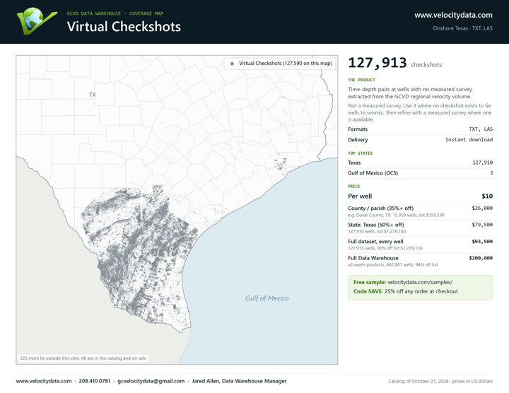
Time-depth pairs at wells with no measured survey, extracted from the GCVD regional velocity volume.
PDF (1.6 MB) On the map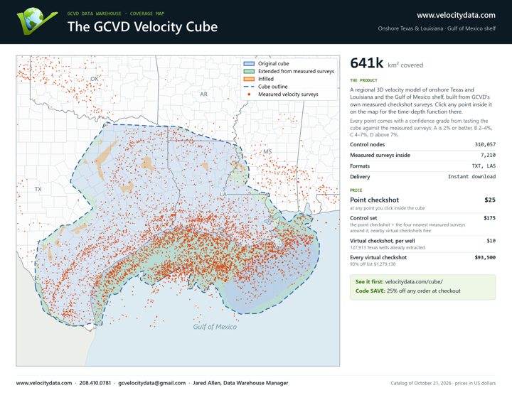
Where a checkshot can be taken at any point, and its confidence
PDF (2.1 MB) About the cubeWant a sample of the data itself? Download a free sample of each product.